


plan_hautonne

ppn
User
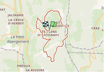

Length
17.2 km

Max alt
1205 m

Uphill gradient
505 m
Km-Effort
24 km

Min alt
994 m

Downhill gradient
505 m
Boucle
Yes
Creation date :
2016-09-06 00:00:00.0
Updated on :
2016-09-06 00:00:00.0
--
Difficulty : Unknown

FREE GPS app for hiking
 SityTrail
IGN / Geographical institutes
SityTrail Plus
The world is yours!
About
Trail Mountain bike of 17.2 km to be discovered at Auvergne-Rhône-Alpes, Ain, Haut Valromey. This trail is proposed by ppn.
Positioning
Country:
France
Region :
Auvergne-Rhône-Alpes
Department/Province :
Ain
Municipality :
Haut Valromey
Location:
Hotonnes
Start:(Dec)
Start:(UTM)
709072 ; 5101969 (31T) N.
Comments